My experience
I'm very enthusiastic about this experience and the challenges proposed because was a simple and smart way to learn new things with the help of tutorials.
The first challenge was about the creation of a dataset of point an add them on a map, the tutorial was very useful and well describe all the step, I had also experience with this so I found it simple and easy to do.
For the second week, the topic was a creation of an app for navigation. The software used were Xcode, Cocoa Pods and the Mapbox Navigation SDK. I didn't have experience with any one of this software. I found into the tutorials all the information needed for Xcode and the Mapbox Navigation SDK. I found more hard to import the SDK with Cocoa Pods, but after some hours of search I found some guides that explain how it works.
The third challenge was the about the creation of an app for 3d visualization of the map created in the first week. The software used were SceneKit SDK, Mapbox Scenekit SDK and the previously used Xcode and Cocoa Pods, then now I was able to use. This time the help present in the tutorial was not very complete and I found also some error in the code present in the tutorial. I found the solutions to these problems with the help of the live streaming where I had the possibility to ask directly help.
I'm very happy about this challenges that let me known lot's about new tools and software. Thanks Mapbox for this experience. :)
First week: Build a map of your favorite hometown spots
This is my map created with Mapbox Studio with some points of interest in Chiavari about local and Tex-Mex food and some beautiful view from the historical castle and all the Tigulio gulf near the sea.
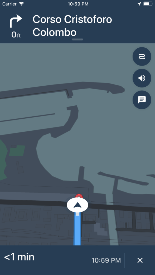
Second week: Help people navigate to your favorite spots
I like very much this challenge was very interesting but hard for the software needed to be used. Above it's possible to see two screenshots of the app during the selection of destination and during the navigation. Above there is the code used to create the app. All the material is also on Github.

Third week: Build a 3D visualization of your hometown map
This was the hardest one for the topic of Augmented Reality (AR), but with the previous knowledge, I found it very satisfying above there is a video that shows the visualization of the 3d map asnd also above there is the code used. All the material is also on Github.
Final consideration
As I told before I liked very much this challenges but I'm not American so I can't be part of this contest so thanks very much Mapbox for this experience and good luck to all the other participants!